Exploring the Galapagos Islands!

WATERWAY CRUISE REPORT

The Galapagos Island cruise reports are among our most popular Waterway Cruise Reports.. .

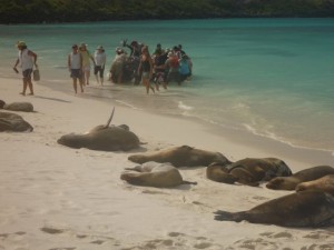
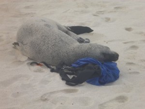
The best part of traveling the Galapagos is an amazing up close and persoal experience with the wildlife who call it home. This seal really loved my backpack!

PART TWO of OUR WATERWAYS CRUISE REVIEW OF VISITING THE GALAPAGOS ISLANDS…. Click HERE to read PART ONE.

Alex was our preferred naturalist… mainly because of his love of the islands, and because of his 20 years of experience! But for those whose personal perspective is that this was a “vacation” and no “mandatory learning” was allowed, we had a second naturalist whose main focus was “learn a little” and have a great time! Every Galapagos naturalist today is professionally trained to interpret and protect this unique natural heritage.

On my first open ocean snorkeling excursion, I panicked and clung to the ladder.

“Alex,” I urged, “don’t wait for me. I’ll just hang here for a while.”

“I don’t go anywhere unless you decide to come with me, or get back in the boat,” he explained. “I don’t leave you in the water alone.” I felt absolutely safe with Alex from that point forward.

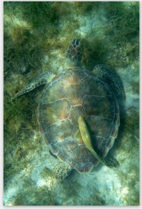
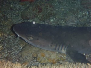
Snorkeling, panga rides, and kayaking were all available options for daily water-based activities. Snorkeling was by far the most popular… Turtles, white-tipped sharks, swimming with sea lions, and even “circling-up” when visited by several hammerhead sharks provided highlites on our Galapagos cruise. Oh yes, and we were joined by a pod of leaping dolphins during one of many memorable panga excursions!

“I really could not believe it was ME out there snorkeling with Hammerhead sharks!” one Minnesota passenger exalted.   And sea turtles were ABUNDANT in the clear waters!
 

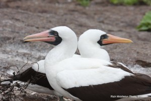
Twice each day, the naturalists led us ashore for an island hike. An afternoon nap was mandatory, so that everyone had the energy to do the really important stuff… like hiking among the booby’s and iguanas, and magnificent Frigate Birds.

The AMAZING thing is  that these creatures truly have no fear of humans!! It was as if we had entered into the Garden of Eden.

While it is not necessary to  be   a student athlete to visit the Galapagos Islands, for the first time on any cruise, we found ourselves to be among the older visitors, rather than the younger!

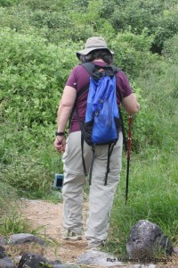
It IS necessary to be able to hike for a mile or two… some of it over rocky lava surfaces, or up and down short steep slopes.

“Wet landings” are common, so be prepared to swing your legs over the side of a rubber panga and in the gentle surf!

I did bring two pieces of “gear” that I found incredibly useful…trekking poles that could be unscrewed to fit in a small carry-on suitcase, and lightweight Salomon’s “Amphibian” style hiking shoes with webbing. The trekking poles worked great when we were on lava rocks.

The specialized water/hiking shoes were great for wet landings. The webbing meant shoes dried quickly. The hiking soles stuck like glue to wet rock and afforded comfortable cushioning for the rest of the hike.

Casual dress is definitely the order of the day for this cruise!
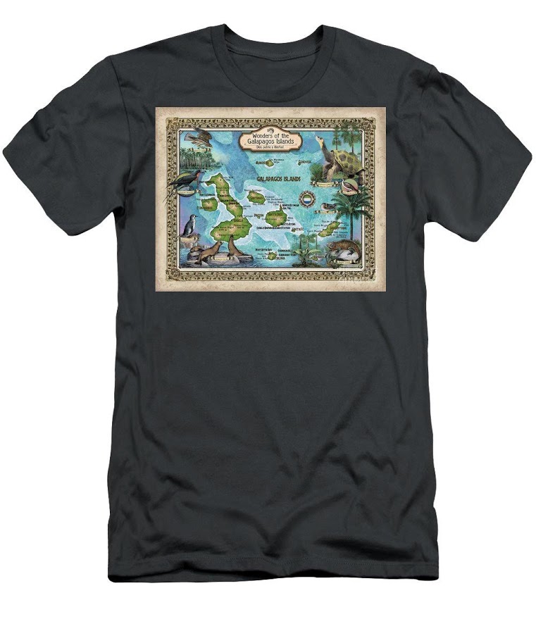
Lisa’s beautiful maps are also available on Textiles!! If you are planning a wedding, family reunion or other activities on a tropical island, textiles make great gifts for the whole group!!  Click this link to see Options!

USGS Reports Earthquake Swarms in Missouri

      Is the big one about to hit the central United States? Maybe not, but a recent swarm of medium-sized earthquakes in Missouri’s New Madrid region has residents on edge.        nmblog_NewMadrid

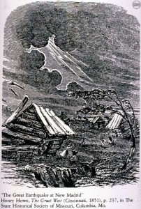
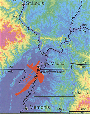
 The area of the New Madrid fault is the site of the nation’s most powerful earthquakes ever east of the Rocky Mountains which occurred in 1811–12 and caused the Mississippi River to flow backwards. This same area experienced six quakes on Monday, September 30, 2019, according to officials with the United States Geological Survey.


Two larger quakes were originally reported as 2.8 in magnitude each. They were later each downgraded to 2.7 magnitude. The third large quake was originally reported as a 2.7 magnitude. It was later downgraded to a 2.6 magnitude.  A sixth was recorded later in the day.

All six recorded earthquakes on Sept 30, 2019 include:

According to the USGS, there have been 12 earthquakes in the past seven days in the Heartland. Click on the blue links for detailed info from the USGS.

New Madrid If an earthquake the size of the 1811-12 earthquake hit today, cities from St. Lto Memphis would see extensive damage in the hundreds of Billions with a loss of possibly thousands of lives. Midwestern cities typically do not have building codes that account for earthquakes because of their relatively rare occurrence.

–Dwight Widaman, Metrovoicenews.com 


INTERACTIVE RIVER MAPS

We are pleased to offer several interactive maps on greatriver.com….  Click on Blue Titles to move to the specific site, or just study the interactive map shown. All maps are constantly updated to reflect real-time activity!
arrow-clip-art-Arrow-clip-art-16CURRENT RIVER FLOOD ALERTS

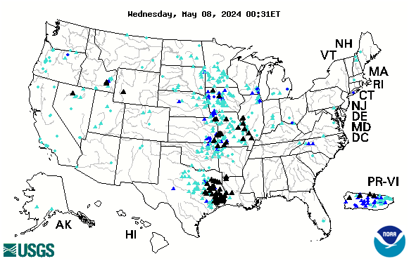
Below is the USGS map that provides REAL TIME info on which Rivers in the US are cresting. The map below is accurate every day. Black Triangles indicate flood stage. Looking to compare stats with the Flood of 1993? CLICK HERE.

us


Generic picture of a barge on a river coming upon a lock
arrow-clip-art-Arrow-clip-art-16Locate A Vessel By Vessel Name Or Vessel Number

arrow-clip-art-Arrow-clip-art-16 Click Here for a List of  Navigable Amerian Rivers


NAVAGATION CHARTS from USACE

arrow-clip-art-Arrow-clip-art-16 Click Here for Upper Mississippi River Charts. Printable page by page in .pdf format
The Upper Mississippi River Navigation Charts cover the Upper Mississippi River from the head of navigation at river mile 866 in Minneapolis, Minn., to the confluence with the Ohio River at Cairo, Ill. The navigable portions of the Minnesota and St. Croix Rivers are also included. The charts were last updated in 2011.

arrow-clip-art-Arrow-clip-art-16 Click Here to DOWLOAD ENTIRE UPPER MISSISSIPPI RIVER CHART BOOK…. 142 MG   Minneapolis/St. Paul to Cairo, IL  866 River Miles. Also the St. Croix and Minnesota Rivers. Carry it with you on your tablet or laptop computer!

arrow-clip-art-Arrow-clip-art-16Click here for Lower Mississippi River Charts.  Download entire book.

Cairo, Illinois to the Gulf of Mexico. River Miles 953 to 0 at A.H.P.


arrow-clip-art-Arrow-clip-art-16  Click here for Illinois Waterway Charts.
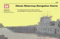
The Illinois Waterway Navigation Charts cover the Illinois Waterway from the confluence of the Illinois and Upper Mississippi Rivers to Lake Michigan at Chicago and Calumet Harbors. The charts have been updated in 2013.


arrow-clip-art-Arrow-clip-art-16 Click here for the USGS EARTHQUAKE HAZARD MAP.

If you enjoy reading about the New Madrid Earthquakes of 1811-12 in Volume 3 of DISCOVER! America’s Great River Road, you will enjoy this interactive map of tremors around the US on a moment by moment basis!

TODAY’s Earthquake Fact:  The Mid-Atlantic Ridge appears above sea-level at Iceland. This offers scientists a natural laboratory for studying on land the processes also occurring along the submerged parts of a spreading ridge. Iceland is splitting along the spreading center between the North American and Eurasian Plates, as North America moves westward relative to Eurasia.

Today in Earthquake History

calendar icon

August 30, 1986
M 6.9, Romania – Damage (VIII) in the Focsani-Birlad area, including the collapse of a church. Felt (VII) at Bucharest. Two people killed, 558 injured,… Read More