For Sale: 54 acre Driftless Region Farmstead, Rural Stoddard

/

Hi Friends and neighbors, very shortly we will be putting our property 1.25 miles east of Stoddard up for sale. This is a heads up, in case you have a friend or relative looking for a beautiful south-facing property in Wisconsin’s Driftless region just 12 miles south along the Mississippi from downtown La Crosse.

 The house overlooks a beautiful and varied 54-acre domain of woods, meadow, pristine spring-fed marsh, robust artesian well and hillsides. Fish the property’s 1 mile of frontage along Coon Creek…one of Wisconsin’s most lauded trout streams. The bottoms provide beautiful and silent cross country skiing. 

South facing decks on two levels of the bungalow style home and an insulated 3 season room provide beautiful vistas of bluff and valley to south, east and west year around.  

The historic 1912 barn stands straight and tall, has a dry hay loft, 2 horse stalls. Great as a walk-in barn for horses or storage for toys and tools. Artesian well just below the house and barn. Historic buggy shed offers a dry home for horse tack, or any other collection that is dear to your heart. Excellent pasture or hay in the meadows, or firewood from the woodlot. Wild grapes and a 35 yr old apple tree as well as perennials make even the yard productive.

Neighbors practice quality deer management so plan your hunt for the big buck! Or watch the hunt from the sun porch or decks! The wetland meadows provide a natural refuge with  nesting sandhill cranes, playful otters, muskrats, resident eagle, and fawns are raised annually on the homestead hillsides. Watch Turkeys strut as well as pheasants, trumpeter swans and Virginia Rail which populate your piece of the Mississippi River valley. Listen as Tundra swans fly low to land between Stoddard and Goose Island.

Visit this link on Lisa’s Facebook page for many more pix! 

https://www.facebook.com/share/p/XD8GeXUJuKKpkZio/?mibextid=QwDbR1

https://www.facebook.com/share/p/RM2ecck427coJqwe/?mibextid=xfxF2i

For many more pix, please click this link: https://www.zillow.com/homedetails/W987-Cedar-Valley-Rd-Stoddard-WI-54658/113688381_zpid

3 bedrooms, 2 bath home of approx 2500 sq ft. 2 car garage. High topped boat/RV storage off the barn.  Hardwood floors throughout the main floor. Finished walk-out basement with family space, laundry, a huge office space. New heat pump, furnace and kitchen appliances. All systems work as they should. Fireplace in living room. Wood stove in basement. Both with stainless steel chimneys. Large open kitchen. New roof on house and barn. 

Upstairs is finished with bedroom suite, 1/2 bath, walk in closet. Large attic space is unfinished. 

Owner may accept, counter offer, or refuse any offer. Sold as is. Look for more pictures on Zillow (address W987 Cedar Valley Road, Stoddard, WI  54658) or the public Farm for sale album on Lisa Middleton’s facebook page noted above. 

 Call Rich 309-200-7473 or text Pat at  608-385-2510 for more info (including a map) or to visit the property.  Suggested pricing $675,000-$720,000.

Nearly the entire sideyard is shaded by the great oak. 

:

Tundra Swans Gathering!

Dec 24, 2020. Merry Christmas everyone. Some may be surprised I still have Tundra Swans, pictured in the header. In fact, during the Christmas Bird Count on Dec 19, our La Crosse Audubon group reported counting 2600 Tundra Swans (big movement over the area), and a high number of duck species despite still water areas being frozen. So yes, you may still be seeing Tundra Swans passing through.

(Nov 2020) Now that our Tri-State bluffs are clad mostly in the deep browns of persistent oak foliage, and the first measurable snow has sprinkled down, we are seeing the Tundra swans winging their way into Pool 8 once again! It’s always one of my favorite birding seasons. As is normal, we not only have elegant Tundra swans resting and feeding, but large “mobs” of American white pelicans are gathering. Migrating ducks also form vast rafts…puddle ducks in more sheltered areas; diving ducks in open water upriver of the locks and dams. Check out the rest area near Brownsville, MN, and the open water south of Goose Island in Wisconsin. The highway pulloffs allow parking and offer scopes and often volunteers to help explain why the swans stop in Pool 8 and what other migrating waterfowl might be identifiable. Eagles are frequent and will become even more so in November!!

Monarchs on the Move

We have been watching our local Monarch butterflies since early August, fluttering around our wetland Milkweed and Joe Pye weeds.

With the grand-kids, we have been able to observe the singular egg, the distinctive caterpillars who ate the leaves voraciously…like lawn mowers… the delicate chrysalis, and finally, the magical moments of transformation to an adult butterfly!

Please enter Monarch in the Search Box in the upper right to see more on Migrating Monarchs from GreatRiver.com

Boaters in September will find them frequenting the Mississippi River on their meandering, multi-generational migration to Mexico and back.

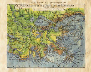
Yes! Great River Arts offers quality note cards, Prints, and Map art for a variety of Butterfly Species. Find beautiful hand-painted map art and quality prints of Mexico and the Caribbean! Visit greatriverarts.com

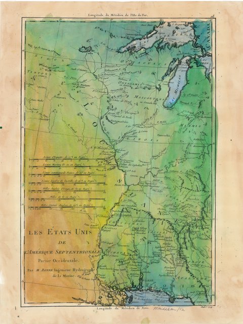
Sandwich Islands, Mexico, Central America, Caribbean, West Indies1878

Re-Discover! America’s Great River Road

Sunny days, green bluffs and sparkling Mississippi River remind us that fun and socially responsible activities are all around us…and not limited just to our beautiful parks!! The Great River Road offers easily accessible scenic overlooks, fishing spots, historic side routes to tiny towns with big stories to share, and a fabulous opportunities for watching large wildlife. Eagles, Sandhill Cranes, Egrets, herons, pelicans, and Trumpeter swans are not hard to spot on a day’s drive. Take a picnic lunch and a copy of the nearest Volume of DISCOVER! AMERICA’s GREAT RIVER ROAD and make each day memorable!!

Check out all our Mississippi River products online at www.greatriverarts.com Are you a Kindle reader? Yes! Books are also available online at Amazon’s Kindle books and in regional gift shops along the river.

at Middleton and Great River Publishing have provided fascinating detail on life along the Mississippi River since 1987! The Mississippi River Activity Guide for Kids will provide summer structure for the elementary aged kids. In Volumes 1 (Upper), 2 (Middle), 3 Lower, 4 (Delta) of Discover! America’s Great River Road, Pat becomes your “friend on the road” providing in-depth background on everything you see along the Mississippi River. Father’s Day is a great time to gift your Dad a fascinating regional book or an historic map he will REALLY LOVE. Check out all our Mississippi River products online at www.greatriverarts.com

Charting Our Course

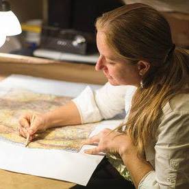
A note from map artist, Lisa Middleton
Friends,we are all charting the course day by day in this confusing time. It seems if we miss the news a single day, everything changes the next, and the world is upside down. Kudos to all of you who are staying home to save lives! My sincerest regards to those who are personally affected by COVID-19. Thank you to those in essential industries who keep the world turning at times like this.

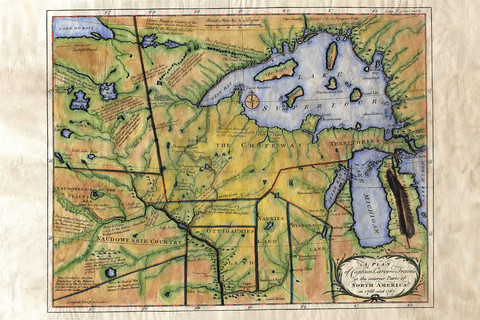
Maps represent our human experiences, memories, and a thousand little stories of the ancestors who beat impossible odds to create the historical maps we hold in our hands today. Our current circumstances are no less difficult, and we can chart the course together, day by day.

What makes our Museum Quality Prints Special

Our maps are unique in the industry! You may have loved ones who had to cancel their vacation, or know of a young couple who had to cancel their wedding or honeymoon. Maybe there is a grandparent in your life who has to be alone in quarantine thousands of miles away from you. There is no better way to tell them you care than to send them a map of a memory, a family legacy or even their dream!

“In her hands, a torn black-and-white 1883 plat of Montana Territory blossoms into a vividly colored snapshot of what the land once was. It remains a map by definition, but by execution it is now an ornate showpiece fit for the living room wall, touched by an artist’s hand with its essential purpose still intact.”
Myers Reese, Montana Quarterly Fall, 2014

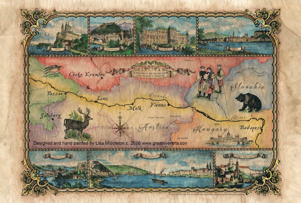
We invite you to browse our galleries of more than 400 antique, Mississippi River, East Coast, West Coast, and original custom designed map art at Great River Arts…. greatriverarts.com !! Enter a key word in the orange SEARCH BOX at the top of the map page to explore the cartographer, the year, region or title that is meaningful to you. We hope you enjoy this gift of art and history!!

Driftless Region Mysteries

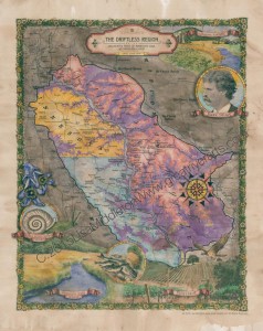
The unglaciated region of western Wisconsin, northeastern Iowa, northwestern Illinois, and southeastern Minnesota is a natural and beautifully sculpted landscape that is known as the Driftless Area. The area is considered “Driftless” because it was not shaped by the movement of glaciers thousands of years ago. A part of the attraction to the region is the forested hillsides that extend into deeply carved river valleys that cut into limestone bedrocks. A key feature that makes the Driftless Area a unique place is the Baraboo Range, comprising of a collection of monadnocks- huge masses of rock rising up out of the middle of a plateau. The Driftless Area is a strange combination of plateau, deep river gorges, sinkholes, bluffs, and monadnocks.

DRIFTLESS AREAThe Driftless Area covers about 20,000 square miles, which primarily extends into western Wisconsin-roughly 85 percent. The landscape has plenty of caves, notably Viroqua City Cave and Cave of the Mounds, and the most rugged part of Driftless Wisconsin is the Ocooch Mountains. In southeastern Minnesota the Driftless Area begins at Fort Snelling, Minnesota, at the confluence of the Minnesota and Mississippi Rivers. This region is defined by vegetation of mixed woodland, goat prairies, and old plateau covered by loess. The Minnesota River cuts across the Driftless Area. In Driftless Iowa the landscape is of forested valleys, streams, rivers, and majestic limestone bluffs. In Illinois, rolling hills and wooded ridges, and features such canyons, ravines, bluffs, and palisades makes up its portion of the Driftless region
Order Your Own Copy of our DRIFTLESS  map Here

The Driftless Area’s forests, prairies, wetlands, and grasslands provides ideal habitat for wildflowers and wildlife. Farming continues to be an activity that thrives in the Driftless Area. Unique soil conditions and higher elevations are ideal for growing particular crops. Amish farmers have long situated themselves in the region, but a new breed of organic farmers has emerged in Driftless. Wisconsin in particular, has expanded into a hotbed of organic farming. The Driftless Region is also ripe for fishing for a variety of trout including brown trout, rainbow trout, and brook trout. Whitetail deer and wild turkey, ring-necked pheasant, along with other games such as ducks and geese, grouse, quail, mourning dove, rabbit, squirrel, raccoon, fox, and coyote can all be hunted in specific portions of the Driftless Area.

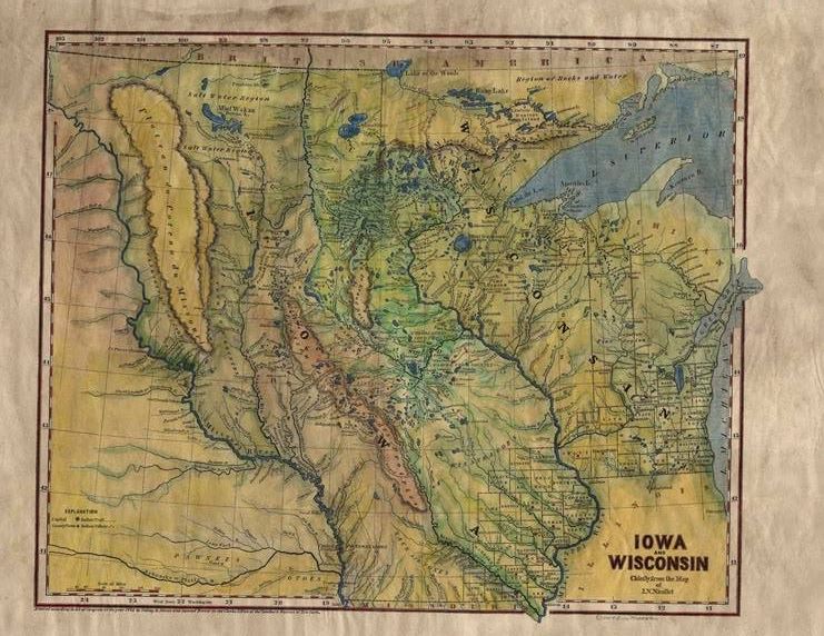
Lisa Middleton’s provides a detailed mapping of the region, and depicts particular features that partly shape the region. The Driftless Region is simply a beautiful and diverse landscape that is like no

Order Your Own Copy Here

You will also love our antiquarian map collection! Click Here


HAND-PAINTED HISTORIC MAPS coming to UW-L Campus, July 27-28,2019

lisa works cropped

Map Artist, Lisa Middleton will display a full selection of beautiful original map art and fine art prints at Art Fair on the Green, in La Crosse, Wisconsin, July 27-28, 2019.

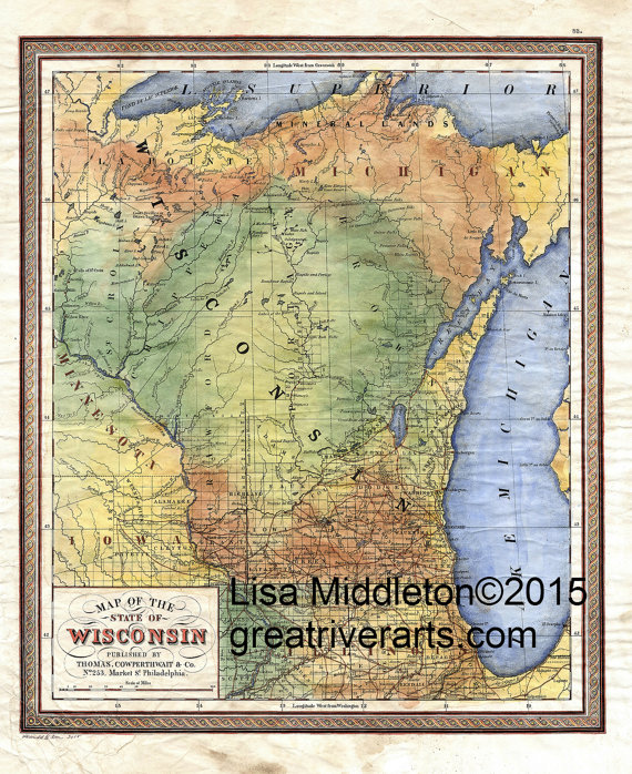
Click greatriverarts.com, for a sampling of Wisconsin, Minnesota, Great Lakes, and Minnesota map art.  Or choose any other key word to explore many 100s of historic and custom map designs in Lisa’s gallery!


New! custom design of
POOL 8!! 

Pool 8 of the Mississippi River


Midwestern Flooding

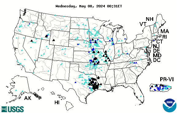
Much of the central part of the country is currently experiencing dangerous flash floods. See up to the minute status reports for American rivers by clicking on our INTERACTIVE FLOOD LINK in the category list to the right.

us

Looking for more great content, lots of river content available by clicking on any of the category links.


Current Interactive Flood Map

Below is the USGS interactive map that provides REAL TIME info on which Rivers in the US are cresting. The map below is accurate every day. Black Triangles indicate flood stage. Looking to compare stats with the Flood of 1993? CLICK HERE.

us

See more interactive maps by clicking the category in the list to right: INTERACTIVE MAPS

Indian Summer in Full Glory… Come Out to Play!

Today and the week to follow is a great time to explore the coulees, streams and river valleys, bluffs and trails of the Driftless Region of Western Wisconsin, NW Illinois, SE Minnesota and and NE Iowa!

Pelicans are mobbing up into great clusters of pristine white on the Mississippi River. Bald Eagles are abundant… we saw several pairs just hanging out in nests, enjoying the day as much as we were!  Can’t say I’ve seen Tundra Swans as yet…which is fine with me as they remind us a frozen river is not far behind!!

The river has finally dropped a bit, so fishing has picked up. Fishing Barges and boat landings we saw were busy.

The Fishing repFun for the whole familyort from Clements Fishing Barge: “November 3rd: Fishing has been pretty good for walleye and sauger.  White bass are done and the perch scarce.  Most fish are coming in on minnows or hair jigs.  Guys are still using 1 oz jigs, water is still higher than normal, but fish are in.”

Enjoy the weekend!