MISSISSIPPI RIVER HOME |
WATERWAY CRUISE
REPORTS | River Books,
Note Cards and Gifts |
Feature Articles |
FISHING|
| Hand-painted HISTORIC MAPS |
River Classifieds |
Contact Us |
Press
Releases | Photo Gallery |
Links |
BIRDING |
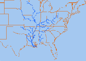
Drainage Map of the Mississippi River
and its Tributaries.
Some Facts and Figures
Click on a tributary to bring up information on that river.
[Mississippi River] [Missouri River] [Arkansas River] [Ohio River] [Others] [Flood of 1993]
[Traveling Waterways of the World] and [Fishing]
For more maps and classroom information on the Mississippi River, check out the
Mississippi River Activity Guide for Kids! Teacher Resource Kit with classroom notes, poster-sized map, and reproduction rights available. Heritage Press, Rt. 1, Stoddard, WI 54658 608-457-2734. Visit the Mississippi River Home Page at http://www.greatriver.com
For Jack, who wants to know more about all the tributaries of the Mississippi River: how many there are, their names, and how long they are!
TRIBUTARIES OF THE MISSISSIPPI
The longest stream of river in the US is the Missouri River which begins at Three Forks, Montana (elevation 4,032 feet) and flows 2,714 miles to near St. Louis, Missouri. Many people consider the Missouri to be the main reach of the Mississippi River!
The Mississippi River, from its source at Lake Itasca in Minnesota, to the Gulf of Mexico, is only 2,348 miles long. The combined reach of the Missouri-Mississippi Rivers is 3,741 miles--a length exceeded only by the Amazon and Nile rivers. The Mississippi River has shortened by several hundred miles since the days of Mark Twain. Even today it varies 30-50 miles each year.
The Ohio River is the second major tributary of the Mississippi. It is formed in Pittsburgh by the junction of the Alleghany and Monongahela River and travels about 980 miles to Cairo, Illinois, and the Mississippi River. Interestingly, today's Ohio River Basin is approximately the northern extremety of the ancient shallow sea that is represented today by the Gulf of Mexico! Consider that nearly 1/3 of the nation's water drains past the confluence of the Ohio and Mississippi rivers at Fort Defiance in Cairo, Illiois!
The Arkansas River forms in the Rocky Mountains in Colorado and meanders 1,450 miles through Kansas, Oklahoma, and Arkansas. It is the main water source for the state of Arkansas.
There are some 250 tributaries of the Mississippi which drain a total area of more than 1,247,000 square miles--one third of the nation's landmass!
Remember the Mississippi River Flood of 1993? It wasn't just the Mississippi River flooding that wreaked havoc, it was that all those tributaries flooded as well! At one point, the volume of water flowing past St. Louis was eleven times the volume of Niagara Falls!!
Still looking for info? Search the rest of greatriver.com and the web!
MISSISSIPPI RIVER HOME | WATERWAY CRUISE REPORTS | River Books, Note Cards and Gifts | Feature Articles | FISHING|
| Hand-painted HISTORIC MAPS | River Classifieds | Contact Us | Press Releases | Photo Gallery | Links | BIRDING |