Timber Rattlersnakes and River Bluffs

A hiker recently hospitalized  after a rattlesnake bite near Caledonia is a rare reminder that there really are rattlesnakes in most Mississippi River blufflands.

My experience with the snakes while hiking
is that they do NOT flee a hiker, but lie still in hopes that we will not see them. Generally, when we do see them, they are laying in the sun on, or at the side of, the hiking path. If we are lucky, they rattle — but only as a last resort.  And not every snake will offer that warning.

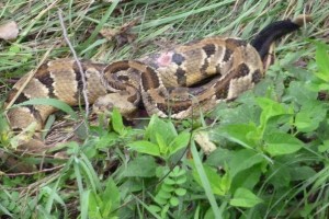
My experience is that they blend into the background so completely they are almost impossible to see without a warning rattle. Coloration of a rattlesnake will vary from gray tones (when they live in limestone areas) to the normal tans and browns or yellows. But the triangular head, and the distinctly black tail with rattles are diagnostic.

I was hiking with a ranger in the bluffs in Missouri on one occasion and he leaned over to pick up a bit of litter… “Oh, shoot,” he said quietly, and slowly pulled away  his outstretched arm. The “litter” was in fact a coiled, nearly gray and white rattlesnake. It did not offer a rattle.

So if you are hiking in the bluffs, stay alert.


FLOOD OF 2011 May Rival Even 1927

Fox News photo of Birds Point Levee floodway


130,000 acres of agricultural land floods after a deliberate break in the Birds Point Levee south of Cairo.

The FLOOD OF 2011 is threatening to rival the flood of 1927!

I can’t think of a more dangerous place to be in the world just now than at the confluence of the Ohio and Mississippi Rivers! Levees completely encircle the city of Cairo, forming an island during floods and the Mississippi River begins to back up into the Ohio River.

For an INTERACTIVE MAP of where flooding is at its worse, visit www.greatriver.com/FLOOD.htm

Some 60% of the water that flows through the U.S. passes through this confluence, including much of the deep south, via the north-flowing Tennessee and Cumberland Rivers. As this is the 150th anniversary of the Civil War, it is worth noting that General Grant named Cairo Fort Defiance when it was occupied by the Union Army.

See more stats on the major tributaries of the Mississippi River by visiting www.greatriver.com/tribs.htm To follow the progress of high water through the small towns of the Mississippi River, read Discover! America’s Great River Road.


“Toots” remembers the Delta Queen

“Toots” Maloy, who for some 30+ years was the “face” of the Delta Queen and Mississippi Queen recently sent me her new memoir of her days on the paddlewheelers.


I found it doubly interesting because it was NOT a history of the company, but truly a memoir of her days on the boats, recounted as she made the last river journey of the Delta Queen to its current Tennessee berth.

Toots also serves as our eyes and ears as she gets a last look at the mold-infested shell of the Mississippi Queen. All of us who loved traveling the Delta Queen fleet, who loved traveling with Riverlorians “Toots”,  Bill Wiemuth, and the rest of the crew, will find this a poignant reminder of how much has been lost with the cruising paddlewheelers.

“We haven’t just lost a vessel,” Toots writes, “we lost a way of life. And with just a stroke of a pen it could have been saved.”

Yes, we have Toot’s book available online at our Mississippi River bookstore. Just $7 plus shipping for a limited time. 54 pages, with 8 pages of photos.

Please click on the link below to order instantly online, or phone 888-255-7726.

A Page Out of History

by Riverlorian, Karen “Toots” Maloy

SECURE online Order Form!

As of 2012, the AMERICAN QUEEN will be BACK on American rivers! Click link to see the update.


A Mid-March “Super Storm” for the Upper Midwest?

OK, I love spring because one day (like today) there is a great sense of expectancy… the sun throws long morning shadows, a new bird arrives with every glance out the window (just saw my first starling), they sing in the morning with greater stridency, and the weather is just plain unpredictable.

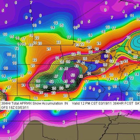
Well, according to Paul Douglas’s weather blog in Minneapolis, another 12″ snowstorm is predicted for the Tri-State area late next week. Here’s the graphic. Paul’s interpretation follows.

Paul Douglas writes:  “Unlike Anything I’ve Ever Seen.  This printout is a prediction for total accumulated snowfall between now and midnight, March 19, 2011. Two separate (major) storms: next Wednesday, another very significant snowstorm possible around March 18-19. The GFS prints out a 53″ bullseye over southwestern Minnesota (Windom area), with nearly 30″ for the Twin Cities between these two storms. Good grief. I pray the models are wrong – but I suspect they’re on the right track. I don’t have to tell you what this would mean for our flood potential come April.”

Paul continues, “The models have been surprisingly consistent in printing out over 1″ of liquid precipitation the middle of next week.  If the storm tracks across southern Iowa into northern Illinois or southern Wisconsin heavy snow bands may set up directly over southern and central Minnesota and much of northern/western Wisconsin. There is a potential for a foot of heavy, wet snow from this storm. Nothing is guaranteed (except sunrise/sunset), so enjoy the relative peace and tranquility. We’ll probably make up for it next week.”

Sandhills announce SPRING, Eagles nest

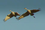
The Canada geese and Sandhill Cranes arrived about 10 days earlier than I expected this year. Ground still frozen, several inches of crusty snow. Three nights ago it was just 15 degrees. They watch the weather currents pretty closely… will delay arrival if they see a storm… so they must know that spring is just around the corner! We’ve located the Valley Bald Eagle’s nest. Believe it is it’s second year. Saw a large handsome eagle standing guard in the neighboring tree last week. Bluebirds and robins abound, but they both spent the entire winter here in the valley. More common than I ever recall during a winter siege!

Imperial Moth in Vernon County, Wisconsin

IMPERIAL MOTH SIGHTING

A first sighting of an Imperial Moth has been recorded in Vernon County, Wisconsin, along the Mississippi River.  According to our source, the moths appear to be making a slow progression northward up the river.  It had previously been found in southern Crawford County, the county below Vernon.

 
Have you found a moth or butterfly you’d like to report to someone? The USGS has a link where you can do just that…    Please see http://www.butterfliesandmoths.org/faq/report for reporting instructions.
USGS National Biological Information Infrastructure
Big Sky Institute, Montana State University

Spring, Spring Spring!!

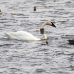
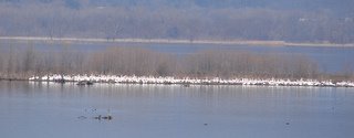
Photo by Rich MiddletonWe’re close to hitting 50 degrees in the Upper Mississippi River Valley. Sandhill cranes, Canada Geese, starlings have all returned. The Mourning Dove is cooing again and the morning is beginning to be vibrant with bird chatter. We’ve heard from the St. Louis area that pelicans are back on their way north. I don’t know that ANYONE appreciates spring like someone who lives up here!
Tracing Banded Swans

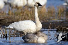
Al Stankovitz Photo of Tundra Swan and cignet

Al Stankovitz Photo of Tundra Swan and cignet

From Alan Stankevitz

Since the weather was so-so yesterday, I wasn’t planning on going down to Brownsville to photograph Tundra Swans but there was a break in the clouds so I headed down there for a bit. Upon my arrival it started to cloud over again (par for the course) but since I was there I decided to stick it out for a while and help answer people’s questions at the observation deck.

I was just about to leave when I spotted a banded Tundra Swan swimming amongst the other swans. This isn’t too unusual. I usually see a few banded swans every year. I report them to the USGS banding center and maybe if I am lucky, I get a response about a year later as to the history of the bird. On a whim, I also emailed a USGS employee who works with banding these swans.

Banded Tundra Swan

Banded Tundra Swan

Within one hour I got a response from him with some rather interesting information regarding this bird. It was banded on July 26th of this year. It’s a male. And it was banded on the Buckland River Delta. Where is the Buckland River Delta? It’s in NW Alaska.

Usually the swans from this region follow the Pacific flyway. This one headed east over the Rockies and Canada. So far it has traveled over 3,000 miles and will more than likely overwinter along the eastern seaboard somewhere between Maryland and North Carolina. This will make its fall migration path close to 4,000 miles!!!

I then asked my contact to trace another swan seen by Dan Jackson on November 6 (photo above).. So far my luck hasn’t run out!  T200 was banded on July 29, 2009 on the Colville River Delta on Alaska’s North Slope. It is not so unusual for swans in this area to head to the east coast via the Mississippi River Flyway.