For Sale: 54 acre Driftless Region Farmstead, Rural Stoddard

/

Hi Friends and neighbors, very shortly we will be putting our property 1.25 miles east of Stoddard up for sale. This is a heads up, in case you have a friend or relative looking for a beautiful south-facing property in Wisconsin’s Driftless region just 12 miles south along the Mississippi from downtown La Crosse.

 The house overlooks a beautiful and varied 54-acre domain of woods, meadow, pristine spring-fed marsh, robust artesian well and hillsides. Fish the property’s 1 mile of frontage along Coon Creek…one of Wisconsin’s most lauded trout streams. The bottoms provide beautiful and silent cross country skiing. 

South facing decks on two levels of the bungalow style home and an insulated 3 season room provide beautiful vistas of bluff and valley to south, east and west year around.  

The historic 1912 barn stands straight and tall, has a dry hay loft, 2 horse stalls. Great as a walk-in barn for horses or storage for toys and tools. Artesian well just below the house and barn. Historic buggy shed offers a dry home for horse tack, or any other collection that is dear to your heart. Excellent pasture or hay in the meadows, or firewood from the woodlot. Wild grapes and a 35 yr old apple tree as well as perennials make even the yard productive.

Neighbors practice quality deer management so plan your hunt for the big buck! Or watch the hunt from the sun porch or decks! The wetland meadows provide a natural refuge with  nesting sandhill cranes, playful otters, muskrats, resident eagle, and fawns are raised annually on the homestead hillsides. Watch Turkeys strut as well as pheasants, trumpeter swans and Virginia Rail which populate your piece of the Mississippi River valley. Listen as Tundra swans fly low to land between Stoddard and Goose Island.

Visit this link on Lisa’s Facebook page for many more pix! 

https://www.facebook.com/share/p/XD8GeXUJuKKpkZio/?mibextid=QwDbR1

https://www.facebook.com/share/p/RM2ecck427coJqwe/?mibextid=xfxF2i

For many more pix, please click this link: https://www.zillow.com/homedetails/W987-Cedar-Valley-Rd-Stoddard-WI-54658/113688381_zpid

3 bedrooms, 2 bath home of approx 2500 sq ft. 2 car garage. High topped boat/RV storage off the barn.  Hardwood floors throughout the main floor. Finished walk-out basement with family space, laundry, a huge office space. New heat pump, furnace and kitchen appliances. All systems work as they should. Fireplace in living room. Wood stove in basement. Both with stainless steel chimneys. Large open kitchen. New roof on house and barn. 

Upstairs is finished with bedroom suite, 1/2 bath, walk in closet. Large attic space is unfinished. 

Owner may accept, counter offer, or refuse any offer. Sold as is. Look for more pictures on Zillow (address W987 Cedar Valley Road, Stoddard, WI  54658) or the public Farm for sale album on Lisa Middleton’s facebook page noted above. 

 Call Rich 309-200-7473 or text Pat at  608-385-2510 for more info (including a map) or to visit the property.  Suggested pricing $675,000-$720,000.

Nearly the entire sideyard is shaded by the great oak. 

:

Tundra Swans, Pelicans, Eagles and Dabblers and Divers Make Their Move!

The Tundra Swans have returned immediately on the tail of one of the most glorious fall displays ever along the Upper Mississippi! And we are expecting a beautiful two weeks of Indian Summer to welcome them back to Pool 8!

So right now is prime time for Swan viewing between La Crosse and Stoddard, Wis. or south of La Crescent to south of Brownsville, MN. Both Wisconsin and Minnesota offer scenic waysides south of La Crosse.

Tens of thousands of swans will stop to rest and feed in shallow open water in the next two weeks. Use your binocs and notice that the American White Pelicans are also here among the swans. If you see a few groups of large 2-4 swans, they are most likely TRUMPETER SWANS. The grayer swans are this year’s cygnets. Many of the swans seen now are family groups, so there will be many young among the flocks.

Leaves have pretty much fallen, so Eagles will seem abundant. Watch for huge black nests and eagle “snags”, dead trees for fishing that eagles will use year after year! It’s a great time to be on the river!!

Much more information from previous posts can be found by using the SEARCH button and such key words as: Tundra Swans or Trumpeter Swans or Pelicans or ducks. Also visit our interactive map measuring the density of bird migration along the Mississippi River Flyway!!

Tundra Swans Gathering!

Dec 24, 2020. Merry Christmas everyone. Some may be surprised I still have Tundra Swans, pictured in the header. In fact, during the Christmas Bird Count on Dec 19, our La Crosse Audubon group reported counting 2600 Tundra Swans (big movement over the area), and a high number of duck species despite still water areas being frozen. So yes, you may still be seeing Tundra Swans passing through.

(Nov 2020) Now that our Tri-State bluffs are clad mostly in the deep browns of persistent oak foliage, and the first measurable snow has sprinkled down, we are seeing the Tundra swans winging their way into Pool 8 once again! It’s always one of my favorite birding seasons. As is normal, we not only have elegant Tundra swans resting and feeding, but large “mobs” of American white pelicans are gathering. Migrating ducks also form vast rafts…puddle ducks in more sheltered areas; diving ducks in open water upriver of the locks and dams. Check out the rest area near Brownsville, MN, and the open water south of Goose Island in Wisconsin. The highway pulloffs allow parking and offer scopes and often volunteers to help explain why the swans stop in Pool 8 and what other migrating waterfowl might be identifiable. Eagles are frequent and will become even more so in November!!

Monarchs on the Move

We have been watching our local Monarch butterflies since early August, fluttering around our wetland Milkweed and Joe Pye weeds.

With the grand-kids, we have been able to observe the singular egg, the distinctive caterpillars who ate the leaves voraciously…like lawn mowers… the delicate chrysalis, and finally, the magical moments of transformation to an adult butterfly!

Please enter Monarch in the Search Box in the upper right to see more on Migrating Monarchs from GreatRiver.com

Boaters in September will find them frequenting the Mississippi River on their meandering, multi-generational migration to Mexico and back.

Yes! Great River Arts offers quality note cards, Prints, and Map art for a variety of Butterfly Species. Find beautiful hand-painted map art and quality prints of Mexico and the Caribbean! Visit greatriverarts.com

Sandwich Islands, Mexico, Central America, Caribbean, West Indies1878

Re-Discover! America’s Great River Road

Sunny days, green bluffs and sparkling Mississippi River remind us that fun and socially responsible activities are all around us…and not limited just to our beautiful parks!! The Great River Road offers easily accessible scenic overlooks, fishing spots, historic side routes to tiny towns with big stories to share, and a fabulous opportunities for watching large wildlife. Eagles, Sandhill Cranes, Egrets, herons, pelicans, and Trumpeter swans are not hard to spot on a day’s drive. Take a picnic lunch and a copy of the nearest Volume of DISCOVER! AMERICA’s GREAT RIVER ROAD and make each day memorable!!

Check out all our Mississippi River products online at www.greatriverarts.com Are you a Kindle reader? Yes! Books are also available online at Amazon’s Kindle books and in regional gift shops along the river.

at Middleton and Great River Publishing have provided fascinating detail on life along the Mississippi River since 1987! The Mississippi River Activity Guide for Kids will provide summer structure for the elementary aged kids. In Volumes 1 (Upper), 2 (Middle), 3 Lower, 4 (Delta) of Discover! America’s Great River Road, Pat becomes your “friend on the road” providing in-depth background on everything you see along the Mississippi River. Father’s Day is a great time to gift your Dad a fascinating regional book or an historic map he will REALLY LOVE. Check out all our Mississippi River products online at www.greatriverarts.com

Sandhill Chicks Exploring the Homestead!

2009 2 chicks hatched successfully!

One of my all time favorite snapshots of the Sandhill Cranes with chicks in 2009. While the chicks (colts) are still quite small, the adults take them strolling through meadow, marsh, and even the pond.

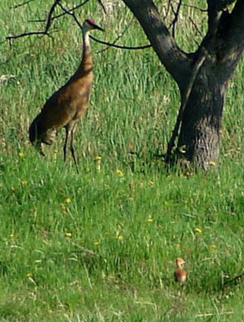
Chick in Front, Dad in shade

May 6, 2020 and our single chick was hatched right on time, in the same locale as the parents have nested for the past 14 years. This year, I noted how very quiet and secretive they were around the nest. The second adult was alway on guard, well away from the nest, quite visible, but always on task. I think having an Eagle in the neighborhood has taught them to be far more cautious than they were in the first ten years!!

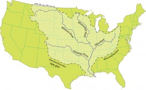
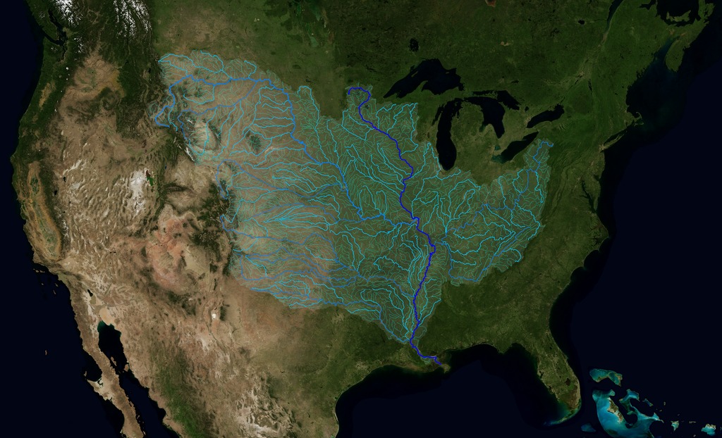
Drainage Map of the Mississippi River and its Tributaries. Some Facts and Figures

QUESTIONS! QUESTIONS!
For Jack, who wants to know more about all the tributaries of the Mississippi River: how many there are,  their names, and how long they are!
NPS.gov watershed tributaries

There are some 250 tributaries of the Mississippi which drain a total area of more than 1,247,000 square miles–one third of the nation’s landmass–extending from the Allegheny Mountains in the east to the Rocky Mountains in the west!

We start here with quick facts on the Mississippi River and several navigable tributaries! Please follow links for a little more depth of historical interest and to see our collection of hand-painted maps!

The Mississippi River, from its source at Lake Itasca in Minnesota, to the Gulf of Mexico, is approximately 2,348 miles long. The combined reach of the Missouri-Mississippi Rivers is 3,741 miles–a length exceeded only by the Amazon and Nile rivers. The Mississippi River has shortened by several hundred miles since the days of Mark Twain. Even today it varies 30-50 miles each year.

The widest navigable part of the Mississippi is Lake Pepin, on the Upper Mississippi, where it is approximately 2 miles wide. The average current flows from 1.2 miles per hour nearer Lake Itasca, and about 3 mi per hour nearer New Orleans. Our historic Mississippi River Ribbon Map has been a best-selling Gift for many years.

Yes! The Mississippi River map can be ordered FRAMED and delivered to loved ones from Great River Arts as a uniquely treasured Father’s Day or Mother’s Day Gift!

“This is a beautiful map!! My whole life is on this map! My home town, the towns where my kids live, even New Orleans, my favorite place to vacation!”

TRIBUTARIES OF THE MISSISSIPPI River  … Watershed map
U.S. Geological Survey EROS Center


Remember the great Mississippi River Flood of 1993? It wasn’t just the Mississippi River flooding that wreaked havoc, it was that all those tributaries flooded as well! At one point, the volume of water flowing past St. Louis was eleven times the volume of Niagara Falls!! You may also want to check out our interactive map of which of the tributaries are at flood stage today! Click INTERACTIVE MAPS in the category list, right hand column, to see where the tributaries are at flood level TODAY!!

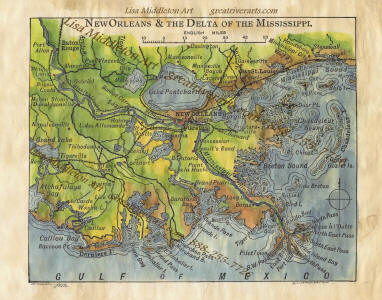
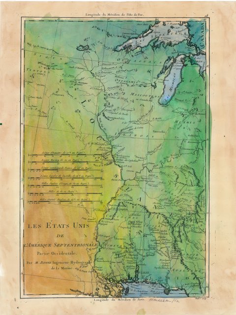
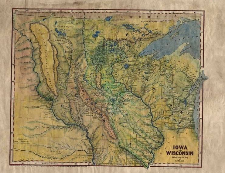
Lisa now offers her own custom ribbon map designs of both the OHIO RIVER and the Missouri River. Please click on any map image for more info on the map or the tributary. Or PHONE 888-255-7726 to order any map. Click on map images for more info on the tributaries.

192 Missouri River Ribbon Map
017 Arkansa Territory 1827
The Arkansas River forms in the Rocky Mountains in Colorado and meanders 1,450 miles through Kansas, Oklahoma, and Arkansas.  It is the main water source for the state of Arkansas.Click here to see
more Arkansas River facts and Artisan Maps by Lisa Midd

/

Ohio River Ribbon Map

The Ohio River is the second major tributary of the Mississippi. It is formed in Pittsburgh by the junction of the Allegheny and Monongahela River and travels about 980 miles to Cairo, Illinois, and the Mississippi River. Interestingly, today’s Ohio River Basin is approximately the northern extremity of the ancient shallow sea that is represented today by the Gulf of Mexico! Consider that nearly 1/3 of the nation’s water drains past the confluence of the Ohio and Mississippi rivers at Fort Defiance in Cairo, Illinois!  

Click here to see more Ohio River facts and Artisan Maps by Lisa Middleton

The Illinois River

Illinois River Ribbon Map

The Illinois River, cutting through steep rocky bluffs, runs approximately 273 miles (439 km), with some 60 miles of scenic water. It flows through the heart of the State of Illinois, and links the great rivers of the American West with the Great Lakes, the St. Lawrence Seaway, and finally the Atlantic Ocean.

Historically, the Illinois River has had a significant impact on the state’s economy, communities, and peoples. Long before Europeans discovered America, indigenous tribes inhabited the Illinois River Valley and settled on the riverbanks, creating a river culture of their own. In 1673, Father Jacques Marquette and Louis Joliet surveyed the region, canoeing up to the Illinois River via the Mississippi River, hoping to find a route linking the Great Lakes to the Illinois River and the Gulf of Mexico. Today, the Illinois and Michigan Canals are the evidence that their vision became reality.

And for fun, checkout our fascinating 1841 STEAMBOAT MAP OF ILLINOIS
lists all the steamboat stops and distances along the Illinois River and the Mississippi, Ohio and Vermillion Rivers!

Wonderful detail!

119 1841 Steamboat Map of Illinois

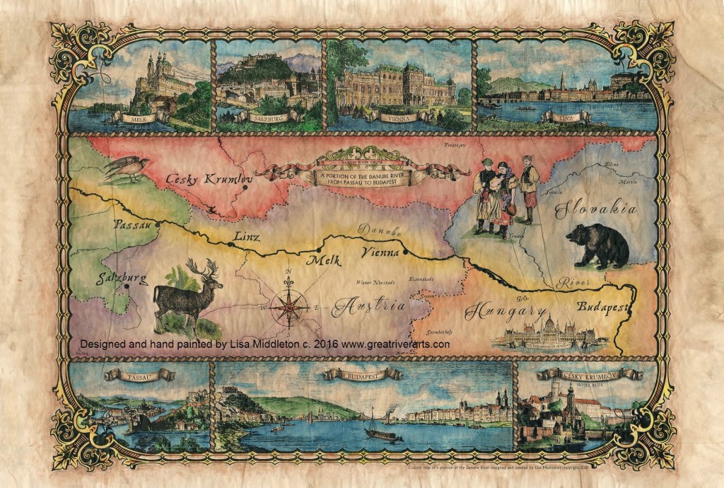
Planning for an upcoming CRUISE? We’ve featured several of our SMALL BOAT CRUISE destinations here!
WATERWAY CRUISE REPORTS

Charting Our Course

A note from map artist, Lisa Middleton
Friends,we are all charting the course day by day in this confusing time. It seems if we miss the news a single day, everything changes the next, and the world is upside down. Kudos to all of you who are staying home to save lives! My sincerest regards to those who are personally affected by COVID-19. Thank you to those in essential industries who keep the world turning at times like this.

Maps represent our human experiences, memories, and a thousand little stories of the ancestors who beat impossible odds to create the historical maps we hold in our hands today. Our current circumstances are no less difficult, and we can chart the course together, day by day.

What makes our Museum Quality Prints Special

Our maps are unique in the industry! You may have loved ones who had to cancel their vacation, or know of a young couple who had to cancel their wedding or honeymoon. Maybe there is a grandparent in your life who has to be alone in quarantine thousands of miles away from you. There is no better way to tell them you care than to send them a map of a memory, a family legacy or even their dream!

“In her hands, a torn black-and-white 1883 plat of Montana Territory blossoms into a vividly colored snapshot of what the land once was. It remains a map by definition, but by execution it is now an ornate showpiece fit for the living room wall, touched by an artist’s hand with its essential purpose still intact.”
Myers Reese, Montana Quarterly Fall, 2014

We invite you to browse our galleries of more than 400 antique, Mississippi River, East Coast, West Coast, and original custom designed map art at Great River Arts…. greatriverarts.com !! Enter a key word in the orange SEARCH BOX at the top of the map page to explore the cartographer, the year, region or title that is meaningful to you. We hope you enjoy this gift of art and history!!

Sandhill Cranes Across the State!

I have been checking the Wisconsin Bird Network frequently and seeing reports of Sandhill Cranes (and Trumpeter Swans) across the State since early February… in fact even in January! They may even have over-wintered in some few locations to south, as I heard a bit about last year!

Pool 8 of the Mississippi River
Beautiful POOL 8 Map Design by Lisa Middleton!
Click here to view map DETAILS.

“Your work is beautiful.  We ordered Pool 8.  It will look perfect above our mantel. As a plus – our home is near the center of the image. Could not have commissioned a better map!”
~Mark D., Pool 8

What I keep track of here however, is when we first see/hear Sandhill Cranes in our Pool 8 valley… and yesterday, March 8, was the first “hearing” of the year for us. It was very distant, however, and we haven’t “seen” them yet.

All other spring birds are being reported, and where there is still ice on the river, bald eagles are clustering. Nest sites are busy! No word of pelicans yet, but they follow very closely on the breakup of the ice! Happy Early Spring Birding!

Swans Arrive in Sauk County!

Sunday, February 23, 2020

It’s fun to know that others are celebrating our annual “Heralds of Spring” in the same way we do along the Upper Mississippi! This was posted to the WisBirdNetwork… A good two weeks ago I was hearing local reports that there were numbers of swans in open waters on the Mississippi as well. Some may have been TRUMPETERS as Wisconsin had many Trumpeter Swans overwinter. See post below about Trumpeters and lead pellets in the Twin Cities. Now back to our little swan celebration!!!

“At approximately 4:20 pm, two Swans landed at Bakkens Pond. My thought was 
that perhaps those two wintered in Wisconsin. Within 15 minutes, a 
wedge of 11 Swans was observed. Near sunset, there was another wedge with 
about 20 swans, but the angle of the sun prevented an exact count.Enjoy the coming of Spring!”
~~Sharon
Richland Center–Richland County–