ABOUT THE AUTHOR
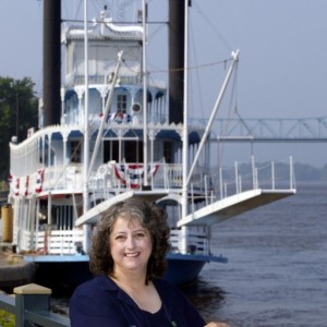
Pat Middleton is the founder/publisher of the Mississippi River Home Page at www.greatriver.com and Great River Publishing which has produced quality river heritage and natural history books since 1987. All our river books, guidebooks, and river art can be seen at our Online Catalog.
Since 1989, Pat has shared her passion for the heritage and natural history of the river with passengers on the great cruising steamboats of American Rivers as a guest lecturer and natural history guide. She frequently speaks to teachers, students, and the general public about life along the Mississippi.
Discover! America’s Great River Road, Vol. 1 guides the traveler. from Minneapolis/St. Paul to Dubuque. Vol. 2 continues the journey from Dubuque to St. Louis. Volume 3 passes through the French Historic District and explores the Ohio River bottoms and the Delta. Vol. 4 follows the river through the deep south to the Gulf of Mexico.
Each book includes notes on special events, heritage and river lore, natural history and recreation along America’s Great River Road.
Call 608-385-2510 to query or click this link to order from our web site!
We hope you enjoy visiting The Mississippi River Home Page at www.greatriver.com!!
ABOUT THE MAP ARTIST
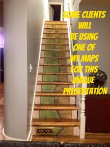
Lisa Middleton began painting historic maps of the Mississippi River in 1996. Today, her hand-painted maps include her own distinctive Custom map creations and collections that include the Midwest, Northwest, Southwest, Southeast, and New England.
See and order from her entire collection HERE! See Lisa’s informative blog and sign up for her entertaining newsletter at greatriverarts.com
 WHAT THE PRESS ARE SAYING ABOUT LISA’s FINE ART MAPS….


Ladies,
I could not be more delighted than I am at this moment, having discovered your Site today, all of your publications, maps, and other drawings. My! What extensive work you have done! If I weren’t so grateful, I might be just a little bit envious.
It has been my dream for a few years now, to drive the entire length of the Mississippi beginning at the northern-most point, spend a little time in New Orleans to catch my breath, and then head back home to the Quad Cities where I am now living. When I make the trip, it is going to be on a shoe-string budget. I plan to either sleep in my car, or camp out along the way. Though I am pretty innovative, and accustomed to “winging it”, I would love to know if you have any suggestions that would speak to my frugal approach to travelling.
I don’t see myself being able to make this trip before the end of the summer, or sometime in 2021. Perhaps you can comment on best/worst time of year to begin such an endeavor relative to weather I might want to avoid or enjoy at a particular location, and which wildlife I wouldn’t want to miss in their natural habitat. Thank you for any input you can provide. As soon as the stimulus money arrives, I plan to purchase several of your books and maps……but hopefully in the next few weeks I will be able to buy your signed Four Volume Set so I can begin reading and planning my trip up and down the River as soon as possible.
Thanks again for all your hard work detailing this information for which I have been so hungry these past several years. The Mississippi River holds such a tender place in my heart, though I have never been able to explain why. Why ask why? I suppose is the logical response to that. It means an awful lot to me to know that there are others who feel similarly, and care enough to document their many fascinating findings. I am sure that all of your books will enlighten me and enrich my life’s experiences as I venture out on my travels and exploration.
Kind regards,
Cat Wylde
309.429.7040
Pingback: Charting Our Course | Ramblin' On
Cat, thank you for your thoughtful note. My very best advice is to purchase the four Volumes of Discover! America’s Great River Road. They will guide you past all the heritage and natural history locations I found most fascinating. And until circumstances allow you to travel the Great River Road, the Discover! America’s Great River Road guides will prepare you for the adventure of a lifetime. And there are not a lot of places on the river that are terribly expensive. Many of the best places are simply a work of love. If you are a camper, most villages offer a free or nearly free campsite along the river. I know you would also like the 1887 RIBBON MAP of the whole length of the river to commemorate your journey. Our Gift Print is 45″ long and shows most of the towns and villages found today. It is beautiful framed and will be a cherished souvenir. Finally as to when to begin from the North… I’d say September would be perfect. You want to catch the Upper River (north of Davenport) during early/mid October. I love Louisiana best during the winter months.
See Books Here or search on Amazon.com
See 1887 Ribbon Map here.