I’m very excited about my newest feature in Montana Quarterly magazine. Montana Quarterly is a very quality magazine available online or wherever fine magazines are sold.


I’m very excited about my newest feature in Montana Quarterly magazine. Montana Quarterly is a very quality magazine available online or wherever fine magazines are sold.


Welcome to WordPress. This is your first post. Edit or delete it, then start blogging!
 This is just a summary of my monthly Newsletter! To see the entire newsletter please click here.
 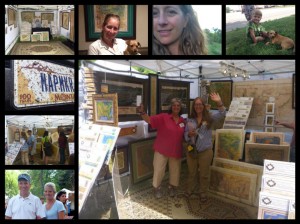 Greetings from the Road!
I’m just about done with my summer tour and wanted to take a moment to announce our August winner and give you some exciting updates!
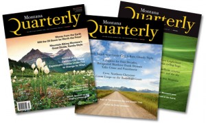 I’m excited to announce that I will be featured in the next edition of Montana Quarterly! I will be sure to post links to the article as soon as it’s published!
 There’s only one book on my list this month…and I am OH SO excited to read it! This is a thrilling tale in to the BLACK MARKET of ANCIENT DOCUMENTS! “The story of an infamous crime, a revered map dealer with an unsavory secret, and the ruthless subculture that consumed him
 Everyone who subscribes to the newsletter is AUTOMATICALLY eligible for the drawing! The raffle winner is determined by a random number generator. Everyone has a chance to win each month. Please sign up for my newsletter here! Please sign up for my newsletter here!
 It sure has been a whirlwind of a month!
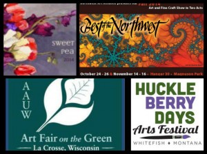
Conference, Jackson WY October 4-5: Issaquah Salmon Days, Issaquah WA (waiting list) October 24-26 Best of the Northwest, Seattle WA
“I have seen your maps EVERYWHERE and have been so looking forward to buying one for myself!”
“I LOVE this map, I KNEW the Scottish were here!”
Explore Lisa’s maps ANYTIME and ANYWHERE online at
Order any map, or let us visit with you about your map needs!
PHONE 888-255-7726 or EMAIL: fineart@greatriverarts.com
Tell your neighbors! Tell your friends!
July 4 Conrad Mansion Ice Cream Social, Kalispell MT
July 11-13 Yellowstone Art Museum Summerfair, Billings MT
July 18-20 Hockiday Art Museum, Art in the Park Kalispell MT
July 28-29 Art Fair on the Green, LaCrosse WI
August 1-3 Sweet Pea, Bozeman MT
August 8-10 Huckleberry Days, Whitefish MT
August 15-17, VALA Eastside, Redmond, WA
September 4-7, Western Design Conference, Jackson WY
October 4-5: Issaquah Salmon Days, Issaquah WA (waiting list)
October 24-26 Best of the Northwest, Seattle WA
Artist Lisa Middleton, originally from La Crosse, Wisconsin, has been painting historic Mississippi River maps for more than a decade and her maps can be found in homes and businesses throughout the United States. Middleton will be sharing her historic map paintings and their stories at the ART FAIR ON THE GREEN, UW-La Crosse Campus, July 26-27, 2014. Her exhibit will include hand-painted historic maps of the Mississippi River and the Wisconsin/Iowa Territory, as well as the Old Northwest in various media.
“I like to work on maps with history; maps of places people love; maps that have stories,” Middleton said. She scours library collections and old bookstores for interesting maps, enlarges them at very high resolutions, and paints them using watercolor and oil pastels.
![]() Middleton’s favorite maps include authentic depictions of wagon roads, native villages and railroads. If a large river, such as the Missouri or the Mississippi is described as “source unknown,” so much the better!
Middleton’s favorite maps include authentic depictions of wagon roads, native villages and railroads. If a large river, such as the Missouri or the Mississippi is described as “source unknown,” so much the better!
Many different things can make a map interesting to customers who often spend a great deal of time browsing through the maps, according to Middleton. Sometimes places on the map have disappeared… like “Waterproof” on Glazier’s 1887 ribbon map. Sometimes maps represent hopeful guessing, such as the Northwest passage created by the Missouri River on her 1732 De l’Isle map, “Carte de la Louisiane”.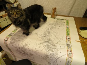
“Sometimes a map brings back a precious memory for a customer, or maybe there is just something about the colors or the location that ‘lifts the spirit,” as one map buff described it. Lisa offers her lively website at www.greatriverarts.com for those interested in exploring map-related books, access to large galleries of Lisa’s historic map paintings, or an insight into the artist’s life.
In addition to historic maps of the Mississippi River Valley, Middleton’s exhibit will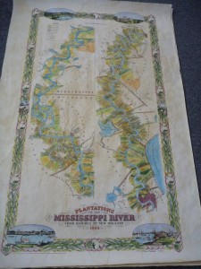 include a large selection of historic maps from the Old Northwest, and many other American and International locations from the Middle East to Norway and France. Visitors will find original paintings, giclee reproductions, and gift prints. She is also happy to accept commissions, with appointments available by visiting the contact page at www.greatriverarts.com
—
CONTACT INFORMATION
Pat@greatriver.com
888-255-7726
Great River Publishing
Or Email the Artist: Fineart@greatriverarts.com
www.greatriverarts.com
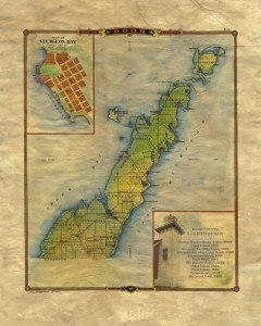 Today we are featuring our NEW 1878 Door County Wisconsin Atlas Map–it notes the location of each lighthouse at that time, all townships, villages, and sections, and a street plan for Sturgeon Bay in the upper left inset.
While the original map featured Jenny, Wisconsin (of Lincoln County), in the lower right, we have provided a list of names and construction dates for each of Door County’s Lighthouses.
Door County was named after the passage between the tip of the Penninsula and Washington Island. The French called it, “Door of the Dead,” and the English/American sailors shortened that to “Death’s Door.” Locals will notice that today’s township of Sevastopol was intended to be Sebastopol, named after a Russian town.
Our map is available as either an 11×17″ map for $24.95 or a beautiful ivory 16×20 print for $50. Both are easy-frame versions for standard-sized frames. Call 888-255-7726 to order direct from Great River Arts, or click the SHOP link above and go to the FINE ART AMERICA link to purchase the print in every imaginable size and medium! Normal trade discounts apply to retailers.
“A NEW MAP OF LAKE PEPIN” by Lisa Middleton is now available for order or purchase from Great River Arts and many fine gift shops and galleries along the Mississippi River. Our popular gift print product with label describing this map is just $28.95. Beautiful when framed!
36″ long and 8″ wide, with totally original design and illustration, this map features both historical and geographical landmarks visible to those cruising by land or river between Wabasha and Redwing. Many islands and sloughs are named.
CLICK HERE to see a high resolution image of this map in our Art Gallery!
Please phone 888-255-7726 to make your order! We have two original paintings and signed and numbered Giclee Reproductions available as well as the Gift Prints!